| "Welcome to the survivors’ last bastion.
This city has no name. It doesn’t need one. It’s the only one left in the world. " |
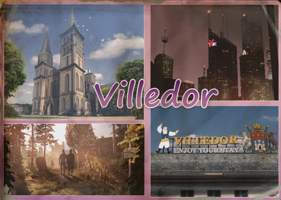
Villedor, also known simply as The City, is a fictional European location and the main setting of Dying Light 2 Stay Human. It is a large, heavily developed urban area located somewhere in Europe, on the banks of the fictional Turzawa River and has a rich history dating back to around 930 AD.
The city's exact location within Europe is up for speculation and is likely intentionally vague, but car registration plates used as decoration in the Tango Hotel and the Fish Eye, indicate that the country Villedor was formerly a part of the European Union (though Villedor's coat of arms are used instead of a country code). This is also supported by the generator output being 230V and 50Hz, the standard across the EU. Electrical outlets appear to be a mixture (a mixture of outlets is common in many parts of Europe) of Type F (a widespread European outlet type) and Type E (used in France, Belgium, Poland, Slovakia and Czechia - though this does not necessarily mean that Villedor was located in any of these countries). Architecture commonly found in Germanic and Slavic countries, and particularly that of Silesia, indicates a location in Central or Eastern Europe. Commercial posters confirm that currency used was the Euro, though "Gulden Coins" are present in the city, however, a poster at the boat house just outside of Villedor strangely displays prices in dollars. It could be the case that, like Harran, Villedor and its surrounding area was a city state.
Villedor is said to be the last inhabited city on Earth, with only minor settlements existing outside it. Infrastructure in the outside world is in a poor state, making travel across long distances difficult. An extremely fortified wall, constructed by the GRE, surrounds the city. There is only one entrance that was not sealed off and outsiders entering the city are rare.
In modern times and prior to the THV outbreak, Villedor had a population of at least two million people, with a Metro System that served approximately one million commuters on a daily basis. There is no figure for the current population of Villedor, but it is significantly reduced and is likely in the hundreds to thousands.
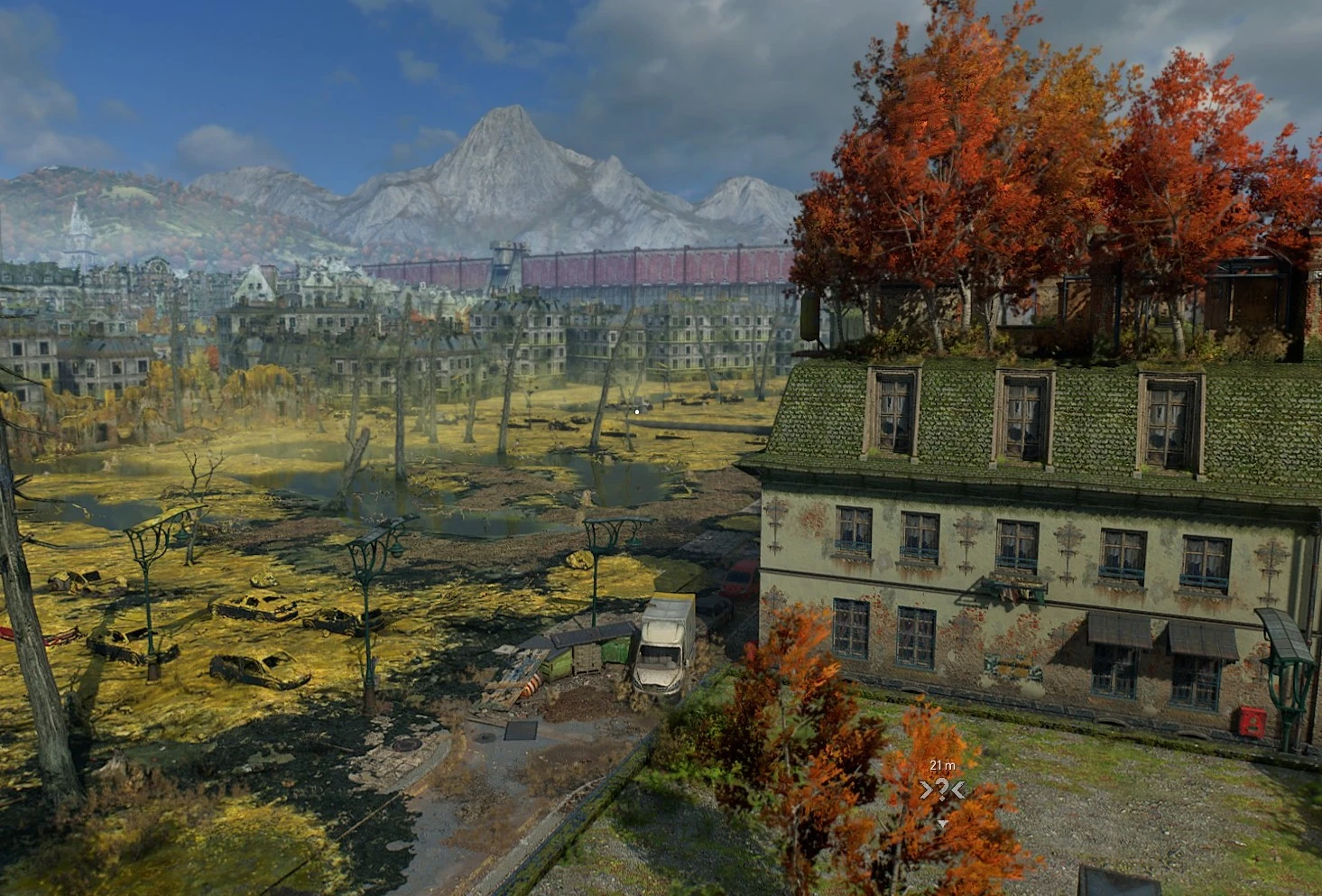
As the events of Dying Light 2 Stay Human take place approximately 20 years after those of Dying Light and 15 years after the general collapse of civilization, the city is in a notably worse condition than players saw Harran, with overgrown streets, dilapidated buildings and rusting vehicles. Highways and light rail/metro bridges running through the city have partially collapsed. Many buildings are overgrown with vegetation. Large portions of the city were rendered uninhabitable by flooding and by the chemical bombings of Black Monday, causing districts to become isolated and connected almost exclusively by the remains of the Metro System.
According To Tymon Smektała, Lead Game Designer for Dying Light 2 Stay Human, the city map is roughly twice the size of the Slums and Old Town of the first game combined and is almost seven square kilometers in total, but he adds that this is a simple answer that "doesn't take into account the verticality of the world"[1]. The map is indeed a lot more vertical than that of the first map, containing skyscrapers, religious buildings, windmills and more. Smektała confirms that 95% or more of the game's interiors is playable, offering challenges for rewards/rarer loot.
02 February 2022
12 February 2016
30 January 2015
History[]
City Development[]
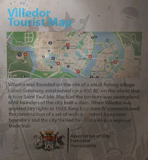

A tourism information sign in Villedor's downtown metro station
Medieval era[]
Villedor began as a small fishing village called Gresburg, established on St Paul's Isle, an island in the Turzawa River, around 930 AD. The river was prone to frequent flooding and the first dam was constructed around this time, though sources vary on whether the dam or settlement itself came first, with some descriptions stating that the dam was built in 927 AD, and others indicating that the dam was built after the founding of the settlement.
Villedor was given its current name by King Engelram IV after the settlement received its city charter in 1033. The same king that gave the city its name also commissioned a set of walls to defend its eastern frontier and significant funds were also devoted to expanding the city on the muddy banks of the river. Villedor soon developed into a thriving trade hub.
At some point, Saxons and Vikings are known to have threatened the area, with water towers now existing on sites where defensive structures once stood.
In 1010 and on the site of a former pagan temple, construction began on Saint Paul's Church now the oldest building in Villedor. It became a cathedral in 1207 after a bishop was installed. Catacombs lie underneath the building, hosting several holy relics, in particular "the index finger from the hand of Saint Paul".
As part of the fortifications built to protect against the Vikings, who attacked via the Turzawa River, Villedor Castle was constructed as Orla Castle in 1115 upon a wooded hill. It is considered to be a stunning example of late Romanesque architecture. The castle, which features on the city's coat of arms, has withstood fires, plagues and world wars. Before it was closed to the public in 2016, the castle drew in thousands of tourists and was notable for its dungeons.
Renaissance era[]
Thanks to trade with the East Indies, Villedor grew in importance during the 16th and 17th centuries, attracting merchants from across the world. In the 16th century, the Central Canal was dug. Commercial ships accessed the Central Canal via a series of locks, manually operated by the "Lock Masters", who resided on Culvert Island. The locks were eventually automated in modern times and Culvert Island was abandoned.
Enlightenment era[]
One of the oldest religious buildings in the city, the Church Of Saint John of God, was built in the second half of the 17th century. The Trinity district was also constructed in the late 17th century.
Sometime in the 18th century, the Chapel Of Atonement, now the Chapel of Resurrection, was built by wealthy Dutch merchant Jacob Linden and was subsequently gifted to the Reformed Church Of Villedor.
In 1772, a devastating fire, known as the Great Linden Fire, took hold in the city. It began in the warehouse of the aforementioned merchant. The blaze destroyed the vast majority of the city, particularly what was known as the Herring district (spelling to be confirmed). A large rebuilding program was ordered, resulting in the construction of the Elyseum district using stone taken from the quarries of Old Villedor.
Linden was convicted of Arson, and the church he had built was seized by the Catholic Church Of Villedor, which renamed it the Chapel Of Resurrection.
Two years prior to the fire, in 1770, the bishop of Villedor commissioned the construction of the Church Of Saint Thomas the Apostle. However, as the Great Linden Fire had destroyed the entire port of Villedor, the delivery of materials needed for its construction was rendered impossible for several years. Work resumed in 1779 and the church was complete in 1786. The bishop never saw it finished, as he died the previous year.
The Church of the Holy Trinity, now known as The Bazaar and home to the Survivors, was also constructed during this period in the Neo-Gothic style, resembling a medieval church. Construction of the church lasted from 1779 until 1804. Also constructed toward the end of the 18th century was the North Saint Paul Canal. During construction works on the canal beside the Church Of Saint John Of God, a "mysterious crypt" was discovered. The crypt remains sealed to this day.
Industrial revolution & twentieth century[]
The buildings of the Houndfield district date back to the 19th century.
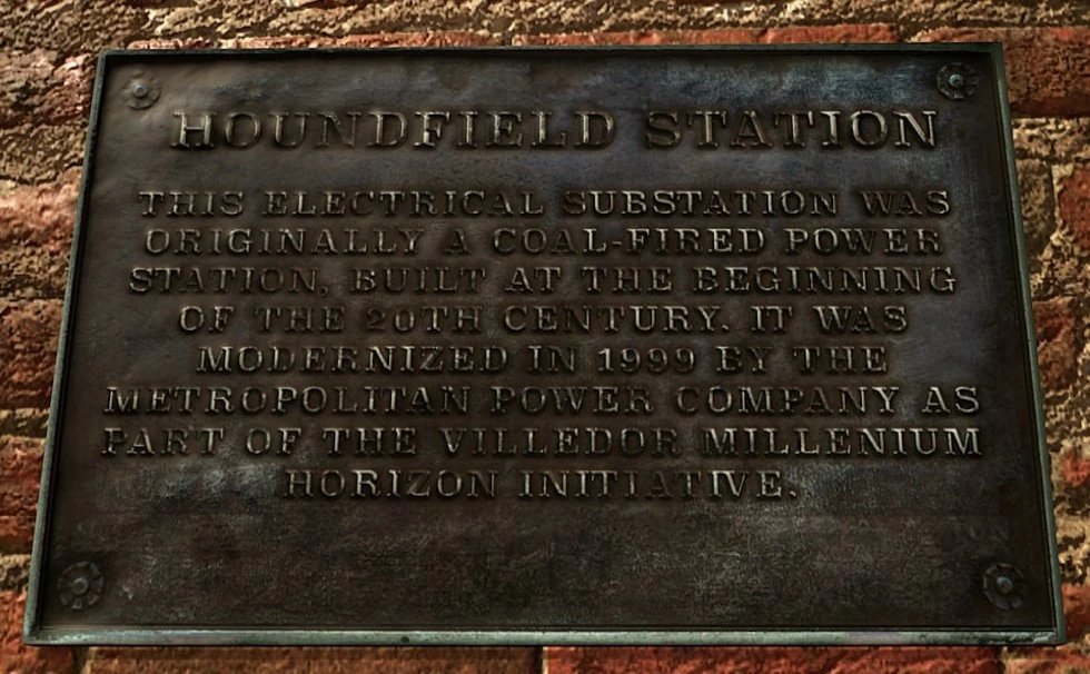

A plaque commemorating the modernization of coal-fired power plants in Villedor as part of the Millenium [sic] Horizon Initiative
At the beginning of the 20th century, several small coal-fired power plants were constructed across the city.
During World War II, the historic center, now known as Downtown, was bombed. It has since been rebuilt as the city's main business district in a modern yet generic style.
After World War II, the received receives funds from the European Recovery Program which were used to construct modern dam, built between 1948 and 1950. In 1947, the city's first radio antenna was constructed. The end of the conflict also ushered in an economic boom, leading to the construction of the emblematic VNC Tower, which was completed in 1959 and remains the tallest building in Villedor to this day. It is described by Peacekeeper Meyer as "once a symbol of the city's greatness". The tower is named after its primary occupant, the Villedor News Corporation.
At some point in the 20th century, Villedor was on one side of the Cold War (we do not know which), with the Mount Lucid Observatory serving as a military base that was actively monitoring this conflict.
In 1971, the Saint Joseph Hospital was completed, replacing the "old, dilapidated infirmary" in Trinity. It was equipped with cutting edge medical devices and later served as a key center for research on the Harran Virus following the 2014 outbreak.
In 1974, then-mayor Marius Cheatkins commissioned the construction of Villedor's Metropolitan Art Gallery, which was officially opened on January 31st, 1977.
In the mid 90s, the Quarry End Swimming Pool, Olympic in size, was constructed on the orders of Conservative mayor Cornelius Dobbs.
In 1999, the North Loop and South Loop radio towers were built simultaneously. The North Loop tower provided radio broadcasting coverage to the Wharf and Muddy Grounds district, while the South Loop tower covered the Lower Dam Ayre and Dam areas. The towers were the last addition to Villedor's Communications Tower network. Also in the same year, and as part of the Millennium Horizon Initiative, the coal-fired power stations scattered across the city were modernized and converted into substations by the Metropolitan Power Company.
21st century[]
Villedor is home to the Dynamo Cars Company, which produced electric vehicles. The company had its head office in the VNC Tower and had a factory to the west of the Central Loop district.
Role in the THV pandemic[]
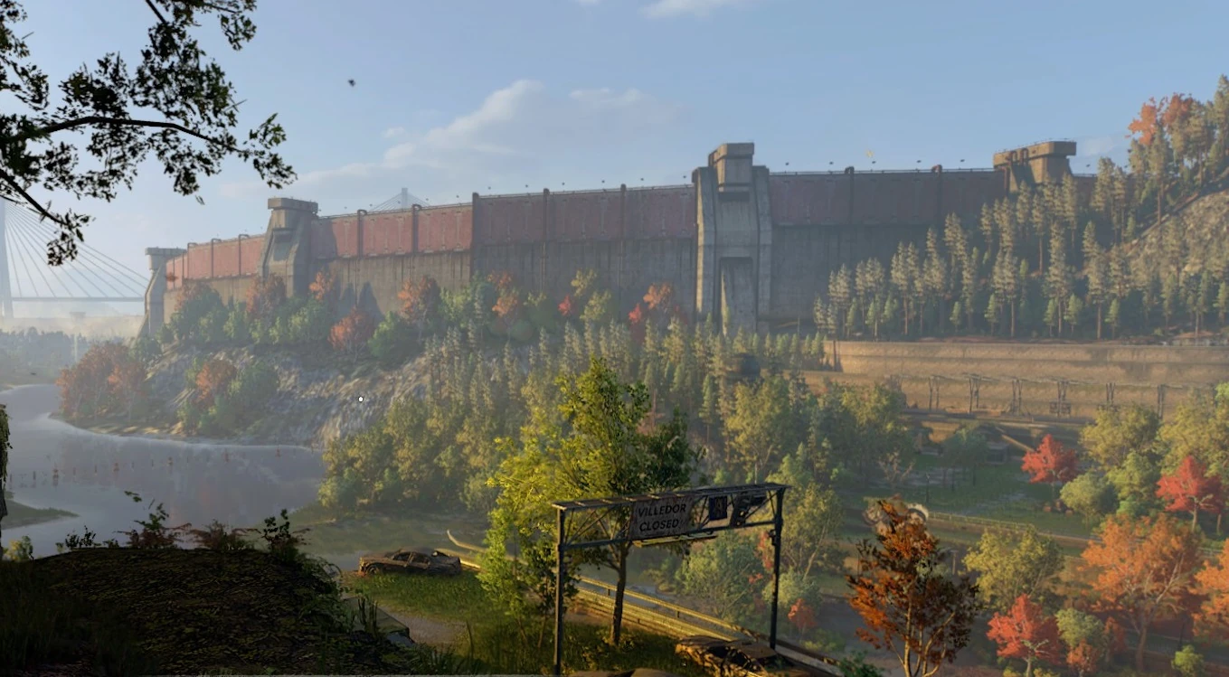
Part of the city wall constructed by the GRE to seal off the city. It now serves as a protective barrier against the outside world.
Management of the pandemic[]
At the beginning of the THV pandemic, Villedor was one of 20 cities isolated by the Global Relief Effort, also known as the GRE. However, the other 19 were destroyed by missile bombardments, making Villedor being the last one to survive by 2036.[2] Ninety-eight percent of the human population was killed as the virus spread and, by 2023, humanity was on the verge of extinction.
At some point during the early days outbreak, the national government released an app called HarranVir Guard and a pandemic update was broadcast every Saturday at 6PM by the Villedor News Corporation. Guidance given to employees of the VNC tower advised social distancing of two meters, among other precautions. At some point, a curfew was introduced by the "Secretary Of Defense" From 10PM To 8AM.
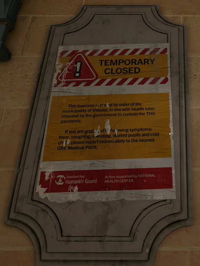
A sign in Old Villedor displaying a notice of temporary closure due to the THV pandemic. An advertisement for the disease management app can be seen at the bottom.
The GRE constructed an enormous wall around the city core with the intention of containing the virus, though it is considered by many to have been its saving grace. Containment barriers between different zones of the city were erected by the GRE in 2022. As a result, whole neighborhoods were isolated from each other and supplies had to be air-dropped in. In 2023, the Dynamo Car Factory was seized by the Army and converted into a solar power plant intended to make the city self sufficient. For a time, the plant powered most of Villedor but mysteriously went offline. In 2024, General Pratt closed the TV station and decommissioned the VNC Communications Tower, the most powerful radio antenna in the city, "in an attempt to contain rumours of the THV infection spreading inside the walls of The City".
A large medical ship delivering drugs, masks and supplies docked at Villedor. It is said that, by the time the ship's mission was complete, the ship's port of origin was lost, and the crew had nowhere to return to. The ship now serves at Peacekeeper Headquarters and Command Central, also known as the Floating Fortress or "Missy", from which all Peacekeeper directives are issued.
THV-GenMod & Black Monday[]
In fall of 2024, a chemical compound called THV-GenMod was discovered which was purported to accelerate the decay of the Infected's DNA and cause their death. On January 6th, 2025, and under the orders of Colonel Williams, also known as The Butcher, the GRE conducted chemical bombings using THV-GenMod across the city of Villedor with the hopes of vaccinating the population and killing the infected. This operation severely backfired and killed over two million people, infecting large numbers and unleashing extreme environmental and urban damage upon large swathes of the city. This event came to be known as Black Monday. That same year, the 2025 Civil War broke out between the Army and the newly formed Peacekeepers, with the Saint Joseph Hospital serving as the site of an intense battle between the two groups.
2036[]
By 2036, the setting for Dying Light 2, The City is considered to be the last bastion of humanity on Earth. The Infected infest the City but are mostly active at night but even then the street level is considered incredibly dangerous. Various factions now inhabit Villedor, such as the authoritarian Peacekeepers, the adaptable Survivors and the marauding Renegades. The Pilgrim, Aiden Caldwell, is in the City in search of a relative who is the key to his past and who he truly is.[3]
Regions And Districts[]
The city is divided into two broad regions, Old Villedor and Central Loop, which are then subdivided into districts that are either held by a faction or neutral at game start. There are also playable areas outside these regions that contain special locations, such as the Dynamo Car Factory. The regions and their respective districts are as follows:
Old Villedor[]
Central Loop[]
Elyseum (currently unplayable)[]
Urban configuration & inhabitants[]
Geography[]
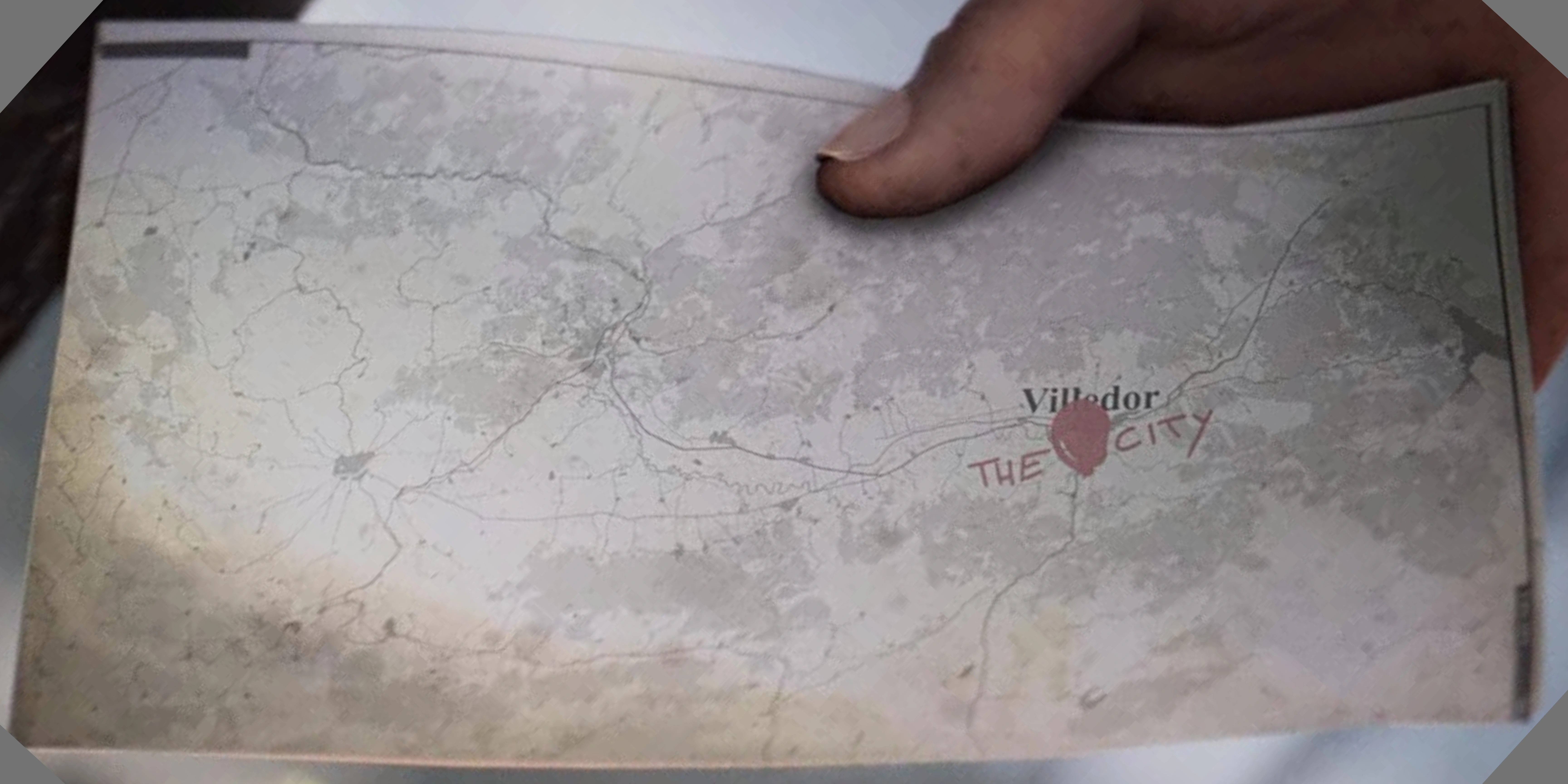
A cropped and rotated screenshot of part of the Dying Light 2 intro, showing a map with Villedor and the surrounding area
The city occupies the banks and islands of the Turzawa River and is in visible proximity to a large mountain range reminiscent of the Alps or Carpathians. The climate appears to be of the continental type, with hot summers and cold winters (based on comments from inhabitants, such as "May Ceres protect our crops from the winter cold."). The city is located inland and the nearest coastline is said to be a considerable distance away, though the presence of the PK Floating Fortress would suggest that the Turzawa River is sufficiently deep and wide to allow large vessels to navigate it, either from the sea or from other river ports.
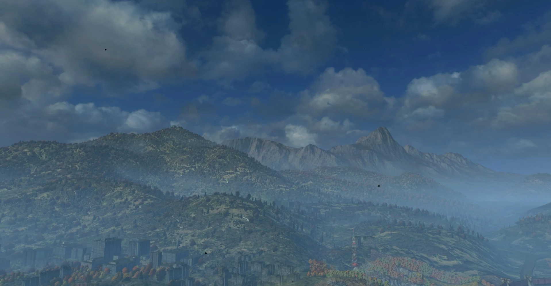
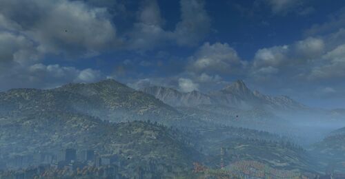
Part of the mountain range surrounding Villedor.
Scale[]
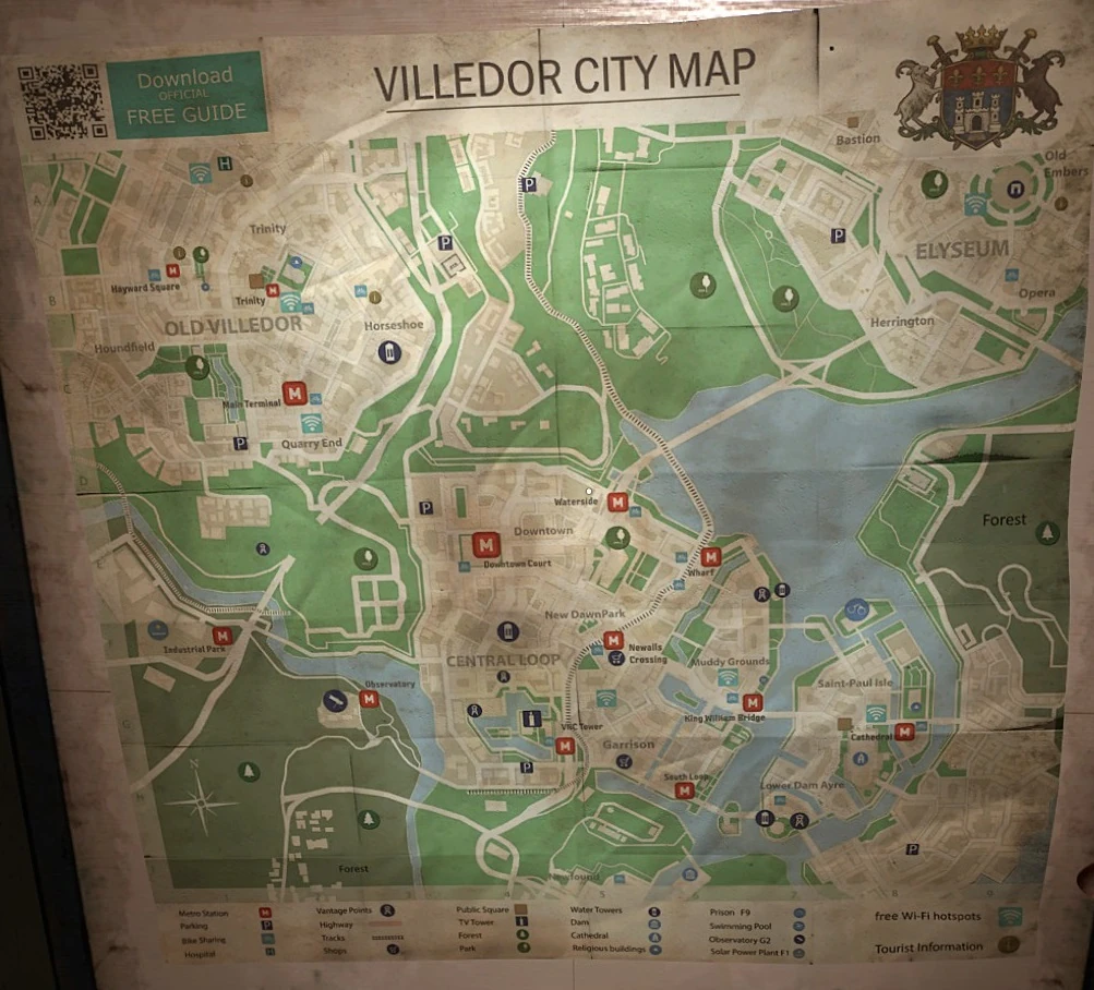
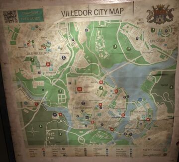
A map of Villedor from before the outbreak
The city is extensive and is large enough for it have been a capital or major city within the country it formed a part of. As previously mentioned, the population is said to have been in excess of two million, though it is not clear if this accounts for the high number of refugees entering the city before the complete collapse of wider civilization. A pre-fall population of more than two million would place the city among the top twelve (adding a space for Villedor itself) most populous European cities by number of inhabitants within city limits.
Pre-outbreak, the city appears to have been a place of both cultural and economic importance, with expansive historical areas attracting tourists and a developed business district hosting offices.
Though the built-up areas are incredibly dense, the city had an abundance of green space and is bordered on two sides by forest. The regions of Old Villedor, Central Loop and Elyseum are separated by parks and hills, though highways do pass through some of these.
Architecture, infrastructure & services[]
Owing to both its long history and its size, the city's architecture varies considerably, from 18th and 19th century townhouses to glistening skyscrapers. Many historical parts of the city appear to have enjoyed considerable patronage from reigning monarchs, and some areas have a somewhat imperial style, attesting to the city's importance throughout the ages.
Many aspects of Villedor's architecture, particularly in Old Villedor, are highly similar to architecture found in Central and Eastern Europe, such as the rounded copper Baroque steeples/onion domes topping the roofs of some buildings, a feature common to churches in Poland, Czechia, Hungary, Austria, South Germany and other countries in this region.
Usage of the fleur-de-lis, for example in the Church Of The Holy Trinity, leads some to suggest French influence, though this symbol can be found in a variety of location across Europe, including in the aforementioned central and eastern regions.
Public Services[]
Emergency services[]
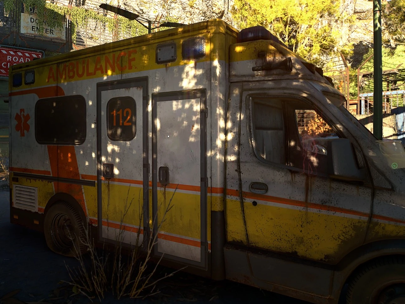
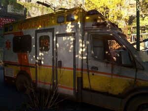
A long-abandoned ambulance with the European emergency number on the side.
The city had a police department and health service complete with hospitals and ambulances. The emergency services number displayed on ambulances is 112, the European emergency number that can be dialed anywhere in the European Union.
Public transport[]
The city features a Metro System, inaugurated on July 6th, 1951. By modern times, the system featured three lines, intersecting at Main Terminal Station, a former railway station converted into a metro hub. This station is the local command center for the Peacekeepers in Old Villedor.

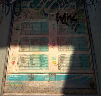
A bus timetable in Old Villedor
An extensive bus network, called City Bus, also once criss-crossed the city, with at least six lines: the 27, 60, 45, 262, 58 and 211.
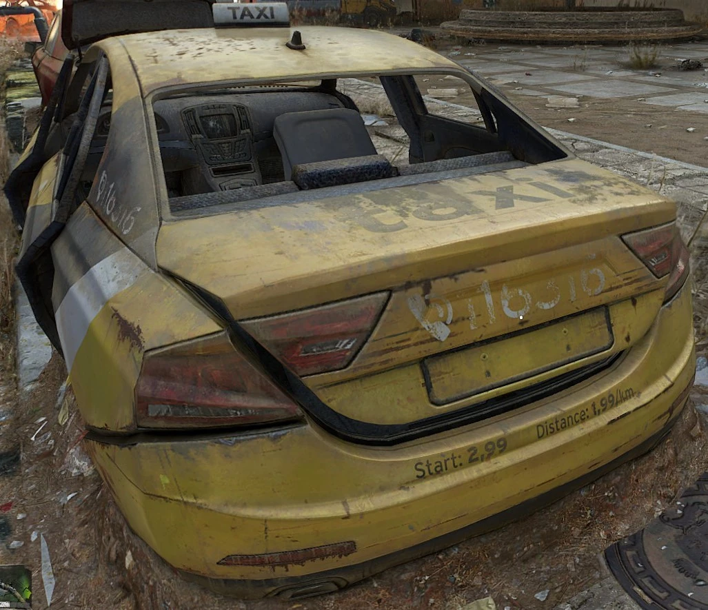
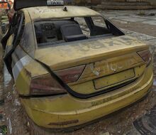
The city also had an official taxi service, the number for which was 116316.
The remains of bike rental stations can also be found.
Commercial establishments and amenities[]
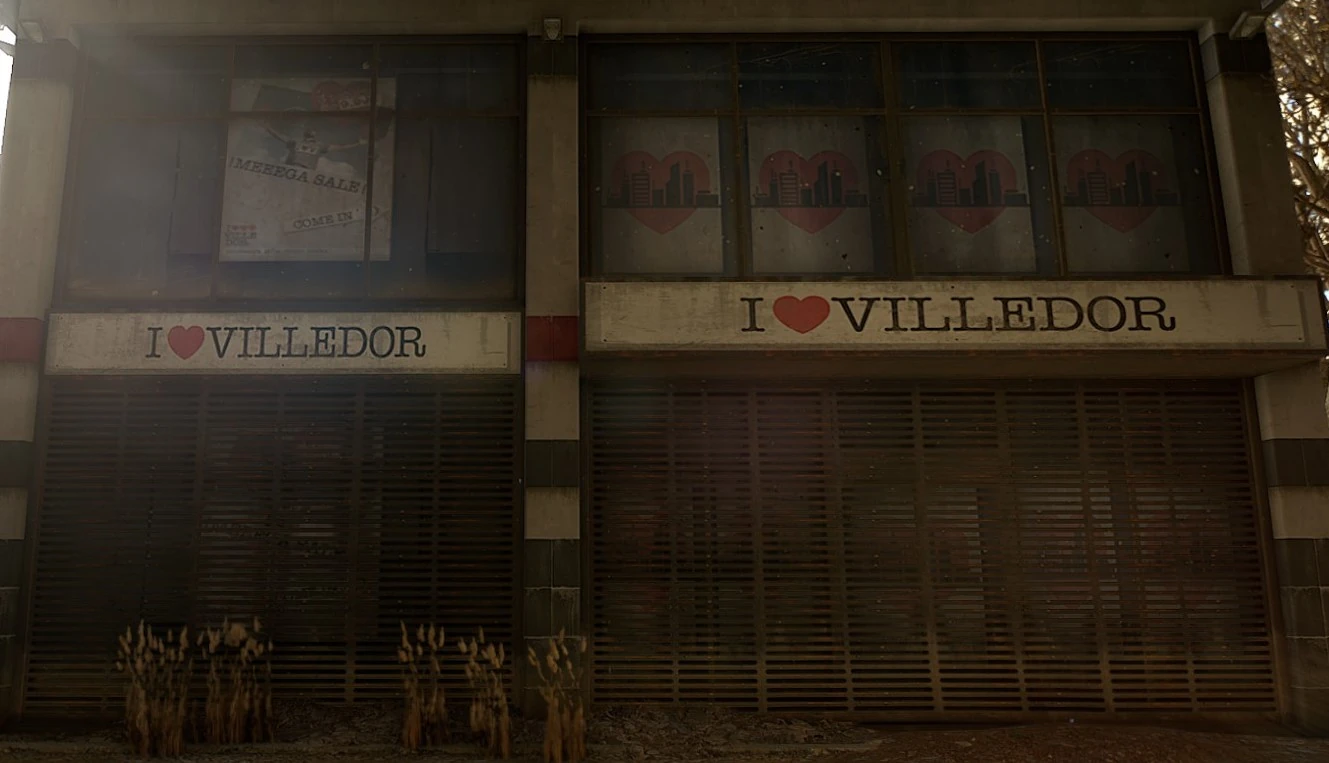
The city is filled with what were once functional apartments, offices, shops, cafés, restaurants and parks. The impression given is that, prior to the outbreak, Villedor was an incredibly busy city with every amenity and comfort on offer and a relatively high quality of life.
Administration[]
The city came under the jurisdiction of the Municipality of Villedor and had several city departments.
Society (post-outbreak)[]

Chemical wasteland produced by the events of Black Monday
After the outbreak yet before Black Monday (which appears to be a significant turning point in Villedor's post-outbreak history), it seems that the city was largely functional and relatively safe, with a form of martial law and food rationing in place, controlling the lives of millions of inhabitants. Evidence of a form of normality, even after brutality on the part of the military regime, exists in the form of structures like the March Massacre Memorial, which was constructed in the middle of an open, non-protected space and using refined, sophisticated techniques and materials commonplace in pre-outbreak society. After Black Monday, however, it appears that any sense of normality in the city was destroyed and the area was left in a semi-wasteland state, leaving disparate groups of inhabitants to pick up the pieces and do what they could do to survive.
Unlike the outside world, virtually all of the inhabitants of Villedor are infected with the THV virus, potentially as a result of the chemical bombings of Black Monday. As a result, everyone is expected to wear a monitor bracelet, known as a biomarker, that tracks the progression of the virus. People without a biomarker are shunned, excluded from access to particular locations and even executed, which almost happened to Aiden upon his arrival in the city. All inhabitants, including Aiden (as he was infected by a volatile while entering the city), must avoid darkness to prevent themselves from eventually turning into fully infected zombies. They do this by being outside during the day, having UV lights indoors and staying in UV-lit areas at night. Homes, shelters and areas where people congregate almost always have some source of UV light, ranging from small lamps to large floodlights.
The inhabitants are incredibly diverse in terms of national origin based on accents and names and there is no clear dominant nationality, in terms of pre-outbreak nations. This could be due either to the city's cosmopolitan nature and international renown, to its importance to refugees fleeing the outbreak, or both.
The city is split into key factions: the Survivors (sometimes called the "Bazaar Folk" or "Bazaarians"), the Peacekeepers (colloquially referred to as "PKs") and the Renegades. Hostile, unaffiliated bandits can also be encountered. Each faction has a different attitude toward how the city should be run/people should live, which is reflected in their buildings and lifestyle.
While the city is factionally divided, its isolation from the outside world combined with the relative frequency of human life and settlements has created a loose 'community of communities' within the area, at least between the Peacekeepers and the Survivors. Trade and transit across the city is relatively common, and although each faction has their own key settlement, not everyone lives close by and are spread throughout the area. Some families are even spread across different factionally controlled districts.
A tourist souvenir shop in Villedor's Central Loop
As the Infected roam the streets below and many interior areas are infested, particularly during the day as zombies seek refuge from UV light, rooftops are a common choice for settlement. Many new structures, crudely constructed from wood and corrugated metal, dot the skyline of Villedor. Electricity is produced by primitive wind turbines and solar panels, as well as electrical plants that can be activated by Aiden as he progresses through the storyline. Residents also have access to water from water towers which, again must be captured by Aiden.

A postcard showing how Villedor used to look.
Society (pre-outbreak)[]
As mentioned, the impression given by remains and by recordings is that city was an extremely cosmopolitan environment with a high population and a diverse array of commercial establishments and amenities. There appears to have been a fairly developed tourism sector.
Trivia[]
- Streetlamps in the older areas of Villedor are almost identical in style to streetlamps in the Polish town of Ostrów Wielkopolski, where Techland's head office is located, with a unique 'dangling' lamp style.
- There are many similarities between Villedor and Polish cities, particularly the Polish city of Wrocław and Warsaw, the locations of two of Techland's main offices. Villedor's financial district bears many similarities with the skyscrapers of Warsaw, constructed on land that was heavily bombed during WWII. Villedor's Saint Paul's Isle appears to shares many features with Wrocław which, like Villedor, was: founded in the 900s on an island (now connected to land) where the main cathedral and other important Christian temples now stand, had a Pagan presence which was overcome by Christianity and was the site of conflict between the Reformation and Catholicism, though these last two similarities are true of many Polish cities.

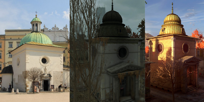
Church of St Adalbert/St. Wojciech (left), Chapel of Resurrection (middle), unnamed church in Old Villedor (right)
- The Church of St. Adalbert in Krakow, Poland, appears to have been used as a model for the Chapel of Resurrection and other religious buildings in Villedor

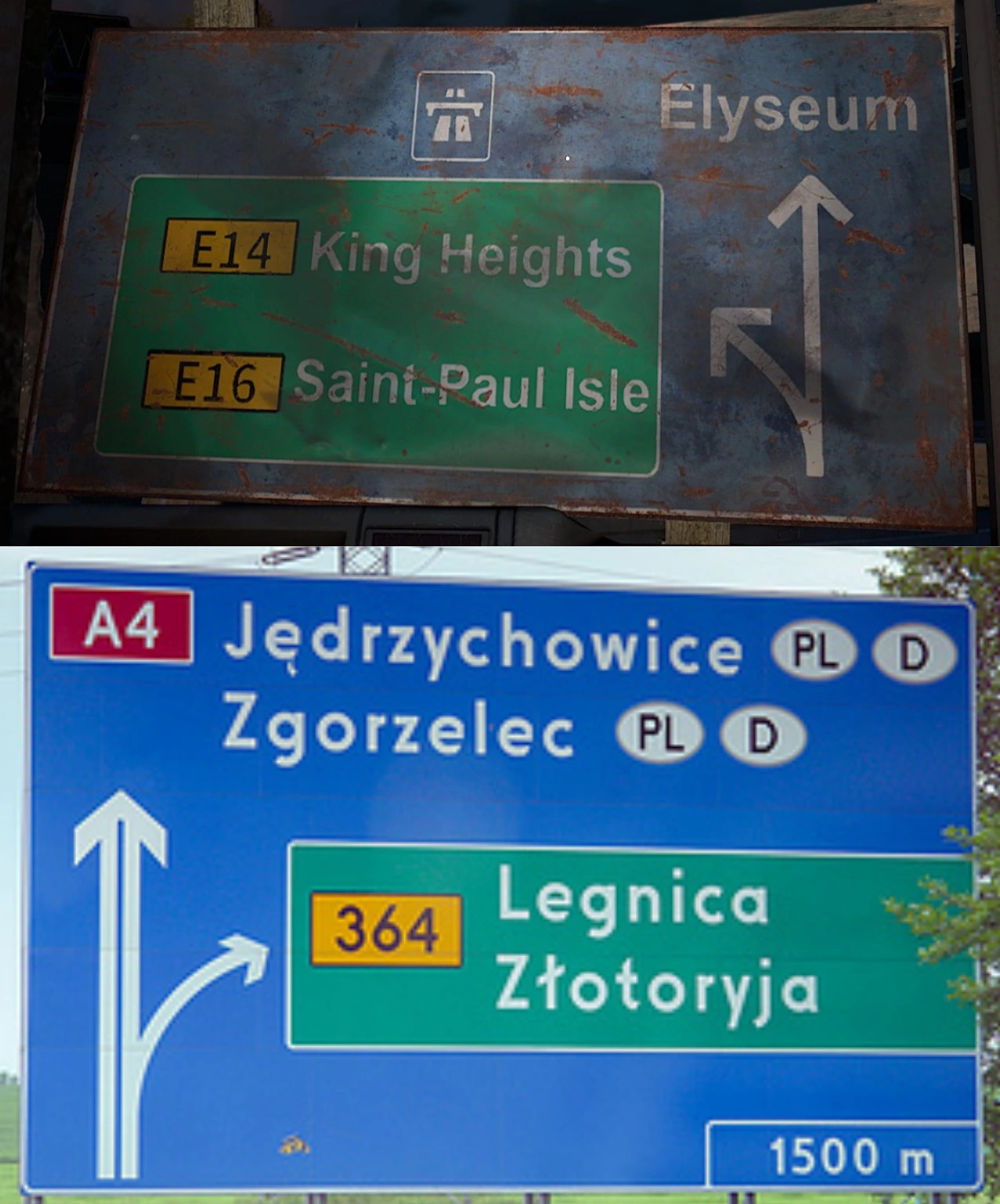

Top: A road sign in Villedor; Bottom: A road sign in Poland
Electrical outlets in Villedor are a mix of Type F (a widespread European outlet) and Type E, used in France, Belgium, Poland, Slovakia and Czechia. Mixes such as these are common in many parts of Europe.

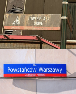
Top: A sign in Central Loop, Villedor; Bottom: A sign in Warsaw, Poland
- Directional road signs around the city appear to be based on Polish roadsigns.
- Street signs in Central Loop are very similar to street signs in Warsaw, Poland

- Goats seem to have been of particular cultural importance as they feature on the city's coat of arms and appear in the form of a repeating pattern on bus seating. They are also used as livestock in settlements.
- The phone number on some electrical warning signs around the city is the malfunction/defects support number for Belgian energy company Fluvius.
- A company name on a boiler in Waltz' quarters ends in "GmbH", which is used for German, Austrian, Swiss and Liechtensteiner businesses.

Gallery[]
")
")
")
")
")
")
")
")
")
")
")
")
References[]
- ↑ https://www.youtube.com/watch?v=d0flaCKpefU
- ↑ Frank Marwey: "Aiden! At the start of the pandemic, Villedor was one of 20 cities to be isolated by the GRE. Do you know how many of them have survived so far? None. Except for ours. They were all blown up when the virus got out of control. Villedor was saved... because someone stopped the bombings. And I think it was Williams."
- ↑ Dying Light 2 Stay Human - Dying 2 Know: Episode 1